The aurora on the viewer's Earth used to be a model of one quiet-to-moderate night, the same ovals round the magnetic poles whatever was happening up there. Now, whenever the clock is at or near the present, it follows NOAA's real data, and so does the Sun, whose spots are now the numbered regions in NOAA's latest report. There are also new aurora pages and email alerts that tell you when it might be visible from where you live. It all comes from public feeds: NOAA's Space Weather Prediction Center, plus NASA's Solar Dynamics Observatory, through Helioviewer, for pictures of the Sun.
Staying cheap on a storm night
Everything goes through one small function on the site, built to stay cheap on the nights people care about most. The CDN keeps each answer for five to fifteen minutes and serves it stale for an hour while it refreshes, and a warm instance keeps each feed in memory while it's fresh, 5 minutes for the OVATION nowcast, 15 for Kp, an hour for the active regions, so a busy storm night costs NOAA a few requests a minute at most.
A feed that fails keeps its last good copy, and if nothing can be fetched at all, everything falls back to a snapshot committed with the site. The SDO images come through Helioviewer because SDO's own "latest" folder went stale in September.
Kp moves the oval, OVATION shapes it
Kp is NOAA's planetary index of geomagnetic activity, 0 to 9 in three-hour blocks, and the feed gives a week of it observed plus three days forecast. While the viewer's clock falls inside that series, Kp moves the ovals toward the equator by 2 degrees for every step, which is NOAA's own rule of thumb, and raises their activity and brightness with it.
Kp alone only tells you how far the oval reaches and how active it is. The OVATION model, which NOAA reruns every few minutes, gives a probability of aurora over the whole globe, with the oval's real shape in it. Within 3 hours of the latest OVATION nowcast, its grid sets the shape and the bright sectors of the viewer's ovals.
Getting a grid into the shader took a bit of thought. The aurora is raymarched through a shell 85 to 330 km up, and the march needs the oval to change smoothly round the pole, so the grid is binned by magnetic local time and fitted with a short Fourier series, four harmonics per hemisphere, one for the main arc's latitude and one for how bright each sector is. That's enough for the oval's offset, its lopsided noon and midnight sides and bright patches a few hours wide, and few enough to stay smooth. The old model is exactly two terms of the same series, so with no live data the look is unchanged, and a test checks that. Set the clock to 1990 and you get the model, set it to tonight and you get tonight.
Why a simple dipole wasn't good enough
NOAA's rule of thumb goes like this: at Kp 0 the equatorward edge of the oval sits at about 66 degrees of magnetic latitude, it moves about 2 degrees closer to the equator for each step of Kp, and you can often see it low on the poleward horizon from hundreds of kilometers further away. I take that reach as 500 km, about 4.5 degrees.
The catch is the words "magnetic latitude". The obvious way to work it out is a tilted dipole, a bar magnet through the Earth, and that's the frame the viewer draws its aurora round. Over Europe it's wrong by about five degrees. Edinburgh comes out at 58.2 degrees on a dipole and 53.1 on corrected geomagnetic coordinates, and at 2 degrees per Kp that's about two and a half steps of Kp of false hope for anyone in the UK.
So the pages and alerts use AACGM-v2 (Shepherd 2014), corrected geomagnetic coordinates that follow the Earth's real field. They're worked out once with the aacgmv2 package at 110 km, about where the aurora's lower edge glows, and shipped as a small grid the pages, the alert job and the tests all share.
Today's Sun
Within two and a half days of NOAA's daily region report, its numbered active regions replace the modeled spot groups on the viewer's Sun. Each one is placed by its Carrington longitude on the IAU's model of the Sun's rotation, checked against Meeus and an SDO/HMI image, then carried forward with the Sun's differential rotation, so the equator runs ahead of the higher latitudes. The spots are built from each region's McIntosh class, area and extent, and when GOES records an M or X flare matched to a region, that region brightens as two ribbons for as long as the clock is inside the flare.
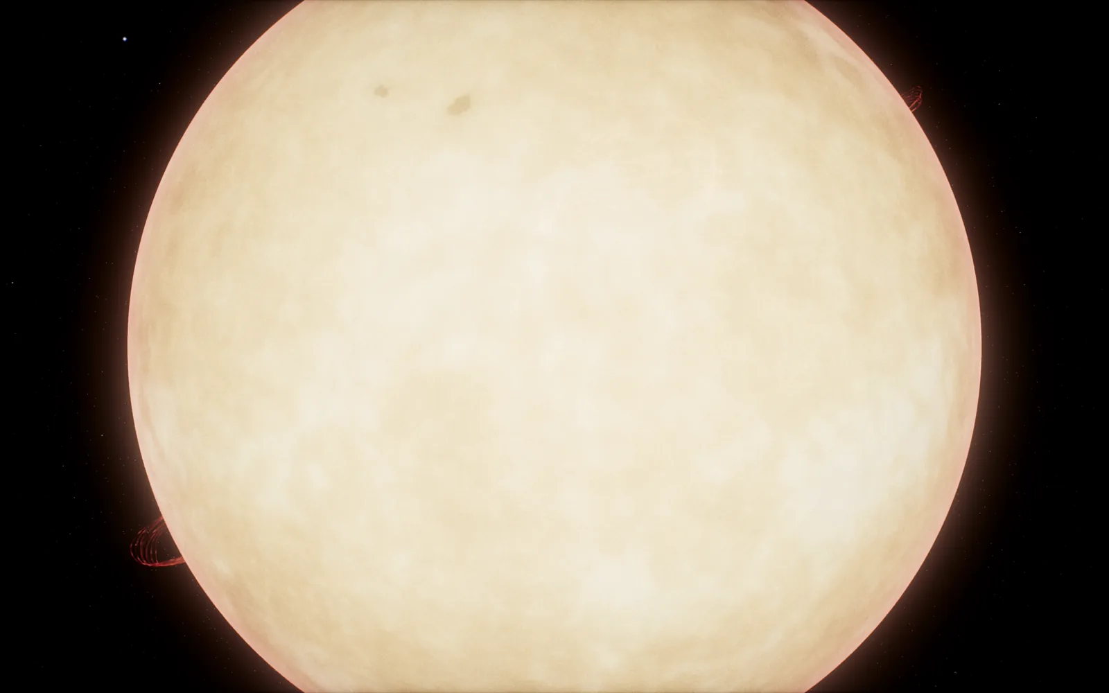
Real regions also showed up a problem with the picture. The bloom, the soft glow that makes the Sun look bright, was spilling over the disc and filling the spots in. In white light a big umbra sits at about 0.23 of the surrounding brightness and the penumbra at about 0.8, so the regions now go in at those contrasts, and a pass after the bloom takes its glow back off the Sun's own disc once the disc is more than a few degrees across. The glow round the edge and the prominences are left exactly as they were.
In the viewer it all sits behind the Space Weather button in the Explore group, with Kp, the solar wind, today's regions, the biggest recent flare with a button that takes you to its peak, and a banner when a storm reaches Kp 6. /viewer/#aurora opens straight onto the Earth and /viewer/#sun-today onto the Sun.
Pages for people standing outside in the cold
The aurora page has Kp now with its three-day forecast, NOAA's OVATION oval on a map, and a "can I see it from here" check for wherever you are. Six regional pages go deeper, from the UK and Scotland to the southern lights over New Zealand and Tasmania, listing towns with their corrected magnetic latitude, the Kp each one needs and its hours of darkness month by month. The space weather page is the Sun today, with the SDO images, active regions, flares, solar wind and alerts.
For the alerts, you give a place and an email and confirm the code, and that's an account with an alert on it. Once a day the job looks at each place's coming night, from when the Sun is 12 degrees down, finds the highest Kp NOAA forecasts during it, and checks that against the place's corrected latitude. It needs at least Kp 3 and the aurora at least on your poleward horizon, and you only ever hear once about any one night.
It works from the three-day forecast, so a storm that arrives without being forecast will be missed, and the pages and the email both say so. Still, the next time the sky goes green over a field somewhere in Scotland, I'd like somebody standing in it to have been told.