Custom star map prints
The sky over you, right now.
Every star, planet and the Moon, exactly where they are. Pick your own moment and keep it.
Working out the sky over you…

Midnight navy · 50 × 70 cm
Look closer.
Every print is drawn at 300 dots per inch. Move across the chart and the circle shows that spot at the print's own 300 dpi: the Moon's own face lit from the Sun's direction, each planet in its place, every star to magnitude 6.5.
At 50 × 70 cm, every planet and the Moon sits within 0.03 mm of where it really was.1
Made of the real sky.
01The Milky Way
The band of our galaxy, from a map built on the Gaia star survey.
NASA Goddard SVS Deep Star Maps 20209
02The stars
Every star to magnitude 6.5, moved by its own motion to your date.
HYG catalogue v4.26
03The constellations
All 88 figures, drawn star to star, with the brightest stars named.
Figures from d3-celestial, after the IAU and Sky & Telescope charts14
04The planets and the Moon
Each planet from a full planetary theory, the Moon with its real face and phase.
Design yours.
Choose the place and the minute. The print redraws as you go, and the line under it tells you what was in the sky.
At home on any wall.
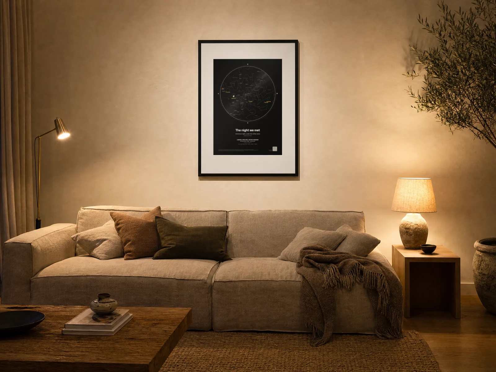
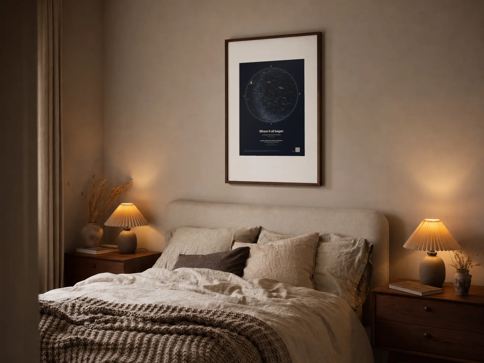


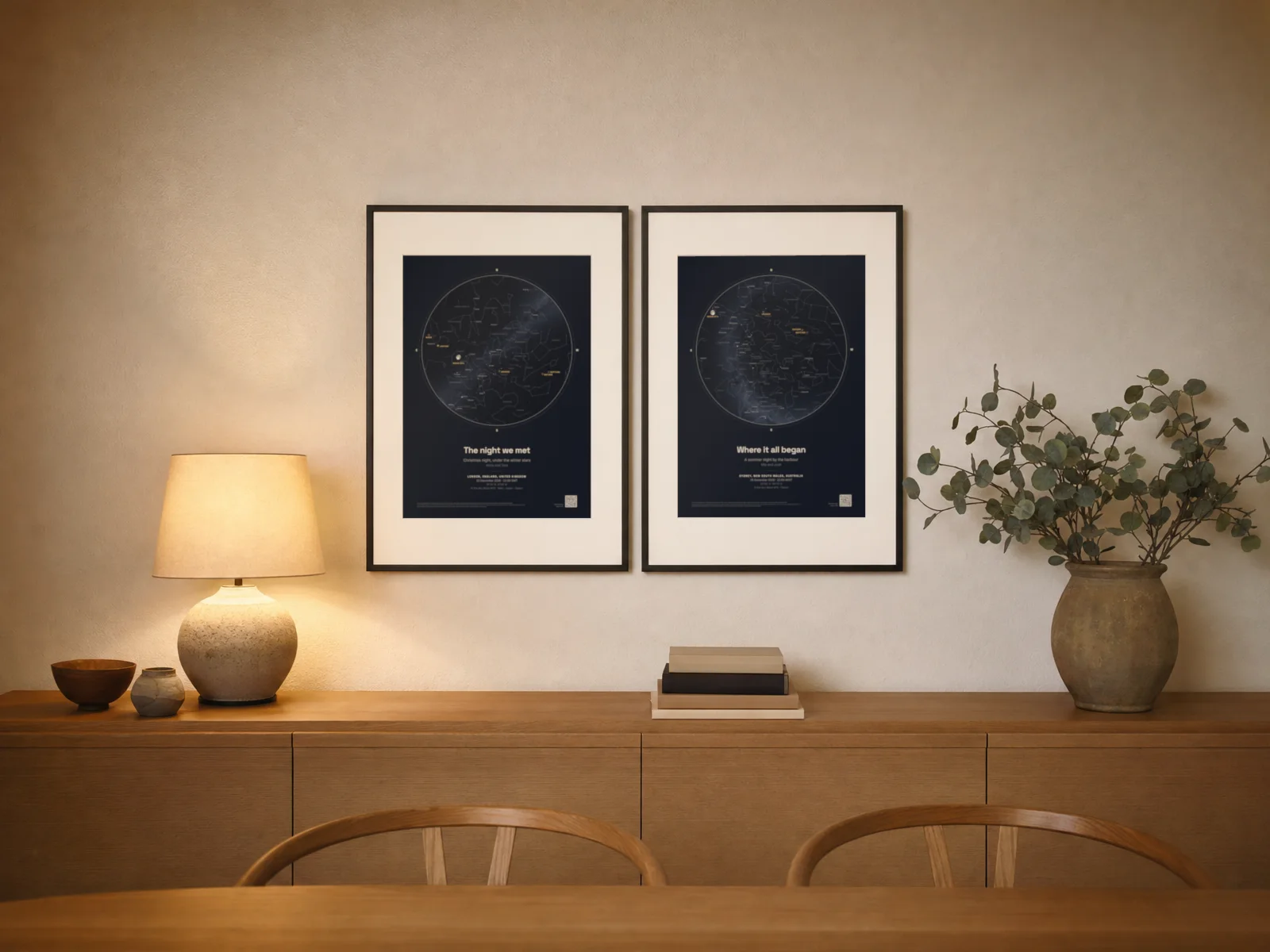
Coming soon
Printed and framed.
Today the print file is yours to print anywhere. Posters and framed prints, made for you and sent to your door, come next.
Scan it and the sky comes alive.
In the corner of your print is a small code, unless you switch it off. Point a phone camera at it and the same sky opens live in 3D in our Astronomy mode: your place, your minute, the stars and the planets as they stood, ready to look around and run forward or back in time.
QR Code is a registered trademark of DENSO WAVE INCORPORATED.
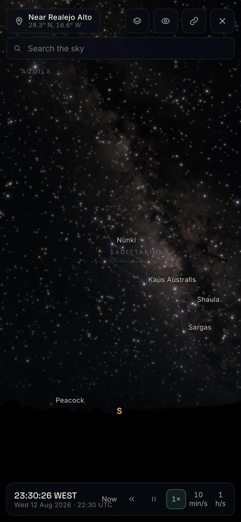
Coming soon
Planet prints.
Posters of the planets themselves, rendered by our 3D engine and lit as they were on your date: Saturn backlit by the Sun, the Moon in its phase, the Earth at night over your town.
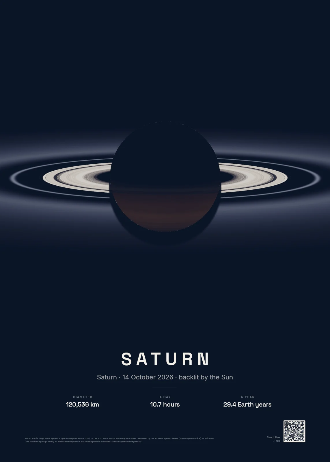
Saturn, backlit
Saturn from beyond the planet with the Sun behind it: the dark globe hides the Sun and the rings glow, lit from behind as they were on your date.
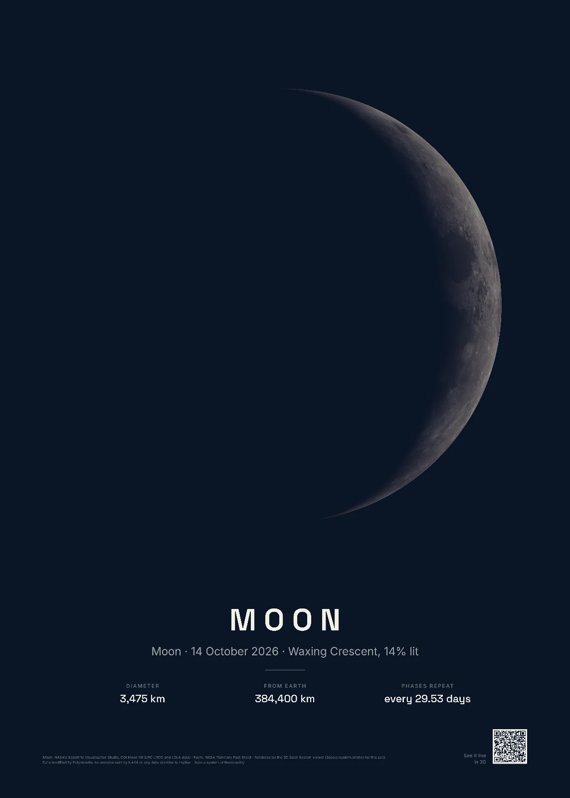
The Moon on your night
The Moon as it was from the Earth on your date: its phase, the face it turned to us and its tilt, from NASA's lunar maps.
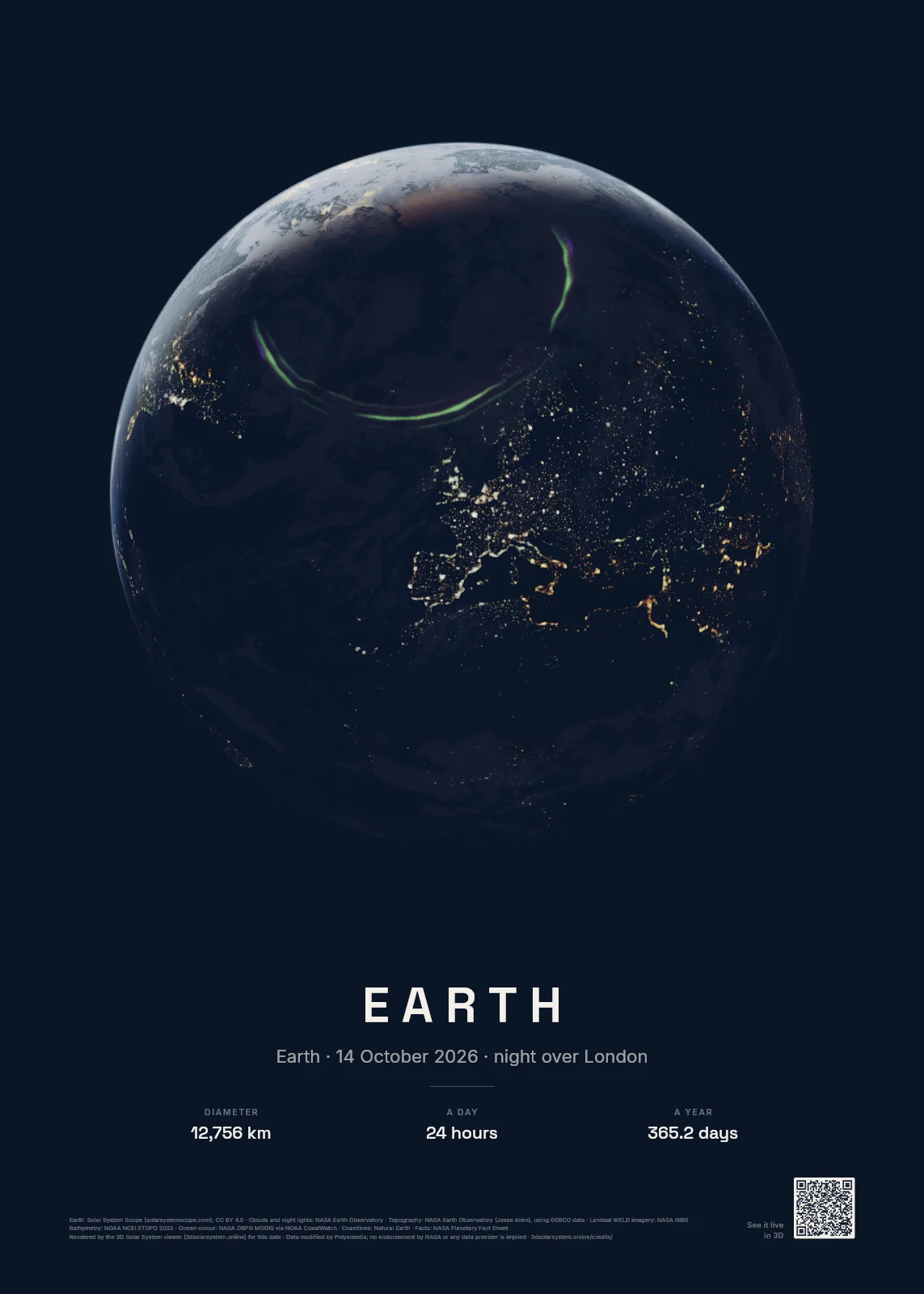
The Earth at night over your town
The Earth over the town you choose on the evening of your date, once the Sun is well below its horizon: city lights on the night side, the day a crescent on the edge.
The details.
How we work out the sky by date and location
Your sky starts with a place and a minute. We turn the time on that place's clock into universal time with the world time zone database, summer time included,7 and find the place among the towns of GeoNames.8
From there the same engine as our Astronomy mode places everything: the planets from VSOP87,4 the Moon from the lunar theory in Jean Meeus' Astronomical Algorithms,5 and the stars from the HYG catalogue, each moved by its own motion to your date.6 It allows for the slow wobble of the Earth's axis and for the air bending starlight near the horizon.
The chart is the whole sky above the place, with the point straight overhead in the middle and the horizon round the edge, north at the top and east on the left: a sky map held above your head. We check it against JPL's Horizons system and the US Naval Observatory: the planets land within 3 arcseconds, the Moon within 12 and the bright stars within 1.5.1,2,3 To check it yourself, open the same moment in a planetarium program such as Stellarium.11
What did the night sky look like on your birthday?
Put in the town you were born in, the date, and the time on your birth record. The designer draws that sky at once and tells you, in a line under the print, which planets were up, how much of the Moon was lit and how many stars stood above the horizon.
Find the sky of your birthday, then keep it as a print or download the free preview. To look round any night without designing a print, see the night sky on any date.
A constellation map, a star map or both
Every print draws all 88 constellation figures star to star, after the IAU and Sky & Telescope charts, and names the brightest stars and the constellations.14 Under Extras you can take the figures or the names away for a plain field of stars, add the coordinate grid, or trace the ecliptic, the path the Sun and the planets follow across the sky.
The Milky Way is drawn from NASA's star maps built on the Gaia survey,9 and Extras can add the fainter stars to magnitude 8 for a fuller sky.
What you get
A PNG file of your design at 300 dots per inch, at the size you chose: 30 × 40 cm is 3,543 × 4,724 pixels, 50 × 70 cm is 5,906 × 8,268 pixels, 12 × 16 in is 3,600 × 4,800 pixels, 20 × 28 in is 6,000 × 8,400 pixels. It carries the colour tags print shops read, and in its small print the credits for the data it is drawn from.
Straight after payment we make your file at full size, ready to download from your order page, and we email you a link to it that keeps working. The free preview is 1,200 pixels wide, with a preview line where the code goes, so you can show it round before you buy.
Printing your star map
Any print shop or online poster printer that takes a 300 dpi file can print it. Order the size you chose so nothing is cropped, and pick a matte paper for the dark themes: it keeps the faintest stars clear of reflections.
The dark skies are a step above pure black and the faintest stars are drawn large enough for a printer to keep, so the Milky Way and the dimmest stars survive on paper. Cream paper suits a light room or a nursery.
A star map for every occasion
The designer has words ready for six occasions, and each of these pages shows a finished example with what the sky held that night.
Questions about star map prints.
What is a custom star map?
A print of the night sky over one place at one moment: a birth, a wedding, the night you met. Ours is worked out from a star catalogue and planetary theory, so the stars, the Milky Way, the planets and the Moon sit where they really were, with your words, the place, the date and time and the coordinates beneath.
How accurate is the star map?
We test it. For four reference moments our chart is checked against JPL's Horizons system and the US Naval Observatory: the planets land within 3 arcseconds, the Moon within 12 and the bright navigational stars within 1.5. On a 50 × 70 cm print the worst of them is less than 0.03 mm from where it belongs.1,2,3
Does it show the planets and the Moon?
Yes. Every planet above the horizon is drawn in its place and named. The Moon is drawn from a map of its real face, turned the way you would have seen it and lit from the Sun's direction, so its phase is the phase it showed. If the Sun was up, it is marked too.
What time should I choose?
The minute you want to remember, on the clock of the place you pick. The sky turns all night, so 21:00 and midnight give different charts. If you are not sure, choose an hour after dark that feels right; the designer tells you if the Sun was still up.
What if the Sun was up at my moment?
The print still shows the stars where they stood behind the daylight, with the Sun marked, and the designer tells you so. Many people choose the first dark hour of the same day instead.
Which dates can I choose?
Any day from 1 January 1800 to the end of 2200, at any minute. The clock rules come from the world time zone database, whose own notes say its entries before 1970 are often uncertain, so for older dates check the zone the designer names beside the time.7
What do I get when I buy the print file?
A PNG image of your design at 300 dots per inch, at the size you chose (5,906 × 8,268 pixels for 50 × 70 cm), ready for any printer. Straight after payment we make your file at full size, ready to download from your order page, and we email you a link to it that keeps working.
Can I print it myself?
Yes. Take the file to a local print shop, send it to an online poster printer, or print it at home on a large-format printer. Ask for the size you chose, so nothing is cropped.
Can I have the chart without any words?
Yes. Under Style, choose No text for the chart alone, with no words or QR code, or Words only for your three lines under the chart. The QR code has its own switch as well. The credits for the star data then come with your file, written into it and listed with your order.
When can I order a poster or a framed print?
We are setting up printing and framing now. Press Notify me and we email you once, the day they are ready.
What does the code in the corner do?
It opens the same sky live in 3D in our Astronomy mode, at your place and minute, so whoever has the print can look around that sky and run its clock forward or back.
Is my location stored?
The place search runs in your browser on the GeoNames list of towns,8 and Use my location asks your browser and keeps the position on your device. Your design is kept in this browser so it is there when you come back, and when you buy, it goes with your order so we can make the file.
Sources
- Our own test of the chart against [2] and [3] for four reference moments (tests/prints-chart.test.js in our code, October 2026): planets within 3″, the Moon within 12″, the navigational stars within 1.5″; under 0.03 mm on a 50 × 70 cm print.
- JPL Horizons System, NASA Jet Propulsion Laboratory. ssd.jpl.nasa.gov/horizons
- Astronomical Applications Department, US Naval Observatory. aa.usno.navy.mil/data
- Bretagnon, P. and Francou, G. (1988), Planetary theories in rectangular and spherical variables: VSOP87 solutions, Astronomy and Astrophysics 202, 309. CDS VI/81
- Meeus, J. (1998), Astronomical Algorithms, 2nd edition, Willmann-Bell.
- HYG Database v4.2, astronexus, CC BY-SA 4.0. astronexus.com/hyg
- The IANA Time Zone Database and its notes on how reliable old entries are. iana.org/time-zones, theory.html
- GeoNames, CC BY 4.0. geonames.org
- NASA Goddard Space Flight Center Scientific Visualization Studio, Deep Star Maps 2020; Gaia DR2: ESA/Gaia/DPAC. svs.gsfc.nasa.gov/4851
- NASA's Scientific Visualization Studio, CGI Moon Kit (LRO LROC and LOLA data), public domain. svs.gsfc.nasa.gov/4720
- Stellarium, free planetarium software. stellarium.org
- d3-celestial © 2015 Olaf Frohn, BSD 3-Clause, its constellation lines after the IAU and Sky & Telescope charts (CC BY 4.0). github.com/ofrohn/d3-celestial
The print's own small print credits its data: stars from the HYG Database v4.2 (CC BY-SA 4.0); constellation figures from d3-celestial (BSD 3-Clause), after the IAU and Sky & Telescope charts (CC BY 4.0); the Milky Way from NASA Goddard Space Flight Center Scientific Visualization Studio, with Gaia DR2 from ESA/Gaia/DPAC; the Moon from NASA's Scientific Visualization Studio, CGI Moon Kit; places from GeoNames (CC BY 4.0). Data modified by Polyxmedia. No endorsement by NASA, ESA or any data provider is implied. Every source is on our credits page.
Prices are in pounds sterling. The print file is a digital download. QR Code is a registered trademark of DENSO WAVE INCORPORATED. Privacy.