Maps from spacecraft and telescopes
Planet textures, and where every map comes from.
Every planet in our free solar system simulator wears a map made from real images: MESSENGER for Mercury, Cassini for Jupiter, Hubble for Saturn, New Horizons for Pluto. Here is each one, what it was made from, its licence and where the free original lives. Then see it wrapped round the planet, lit by the Sun, in 3D.
The map on every world
From the Sun outwards. Each picture is the viewer's own render, with the map on the planet; press it to fly there.
The Sun
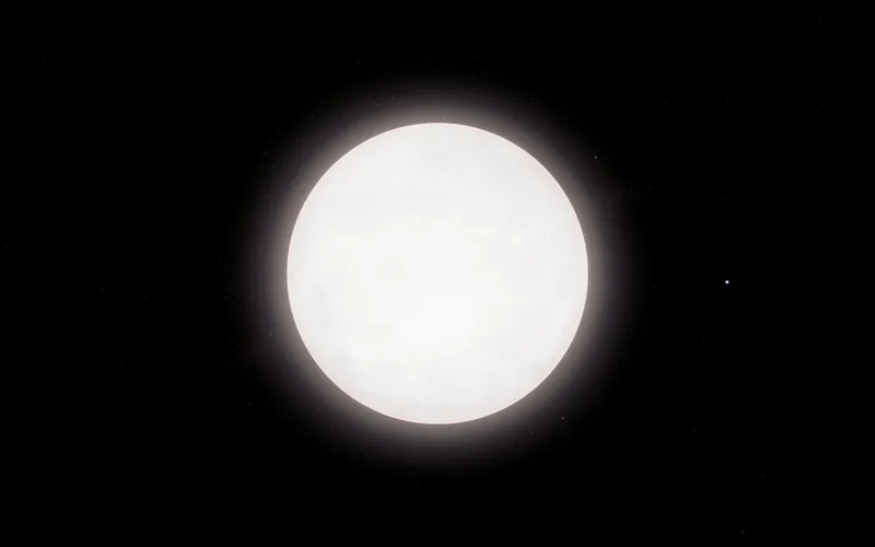
Drawn by shaders, with dated sunspots
Mostly computed. The default style draws the Sun white, with its granulation worked out in the shader. The Detailed style adds a base map we generate to the statistics that shader expects.
In the viewer: 4,096 × 2,048 pixels.
- Our own map (scripts/textures/build-sun-map.py) Made by us for the viewer
Mercury
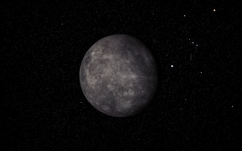
Surface from NASA's MESSENGER
MESSENGER's colour and monochrome basemaps and its global colour mosaic, with the USGS global elevation model of Mercury for the relief.
In the viewer: 4,096 × 2,048 pixels.
Venus
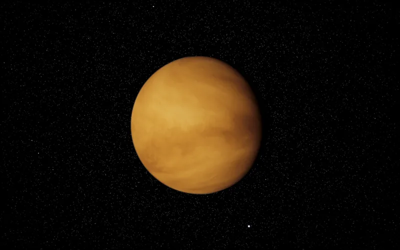
Cloud tops computed live, no map
No map at all. Venus is wrapped in cloud, so the viewer computes the cloud tops as it draws them, aimed at Venus as it looks in visible light: a pale cream disc with very little contrast.
- The viewer's Venus shader Made by us for the viewer
The Earth
NASA's Blue Marble by day, Black Marble by night
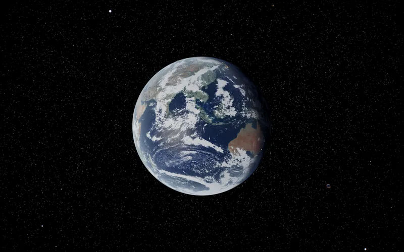
By day, NASA's Blue Marble: Next Generation for June 2004. By night, the city lights of NASA's Black Marble 2016. The clouds are NASA's Blue Marble cloud layer from MODIS on Terra. Zoom in and the viewer streams Landsat and Sentinel-2 imagery down to about 10 m.
In the viewer: 8,192 × 4,096 pixels.
- NASA Earth Observatory, Blue Marble: Next Generation NASA imagery, free to reuse with credit
- NASA Earth Observatory, Black Marble NASA imagery, free to reuse with credit
- NASA Visible Earth, Blue Marble: Clouds NASA imagery, free to reuse with credit
- NASA GIBS, Landsat WELD annual composite NASA imagery, free to reuse with credit
- Sentinel-2 cloudless by EOX (contains modified Copernicus Sentinel data 2016) CC BY 4.0, free to reuse with credit
The Moon
NASA's LRO, from the CGI Moon Kit
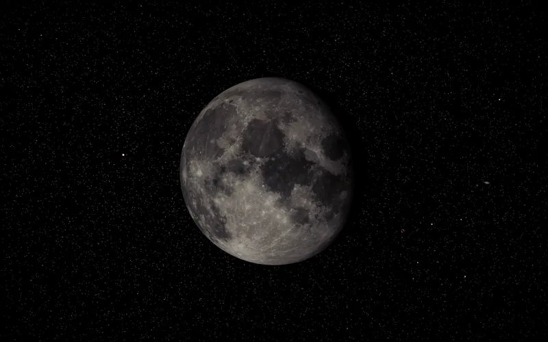
The colour map of NASA's CGI Moon Kit, made from the Lunar Reconnaissance Orbiter Camera's Wide Angle Camera mosaic.
In the viewer: 4,096 × 2,048 pixels.
Mars
Solar System Scope map, NASA MOLA relief
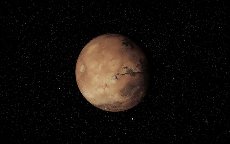
Solar System Scope's Mars map for the colour, with the heights measured by the laser altimeter on NASA's Mars Global Surveyor for the relief. A map built from Viking orbiter mosaics is being prepared to replace the colour.
In the viewer: 8,192 × 4,096 pixels.
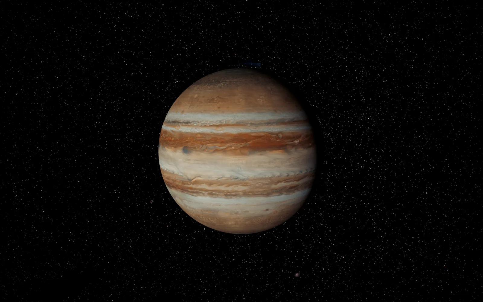
Jupiter
Clouds from NASA's Cassini, December 2000
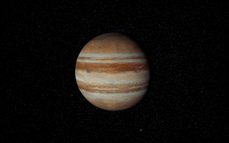
Cassini's global and polar maps of Jupiter's clouds from December 2000, coloured from Cassini's true-colour portrait of the planet.
In the viewer: 4,096 × 2,048 pixels.
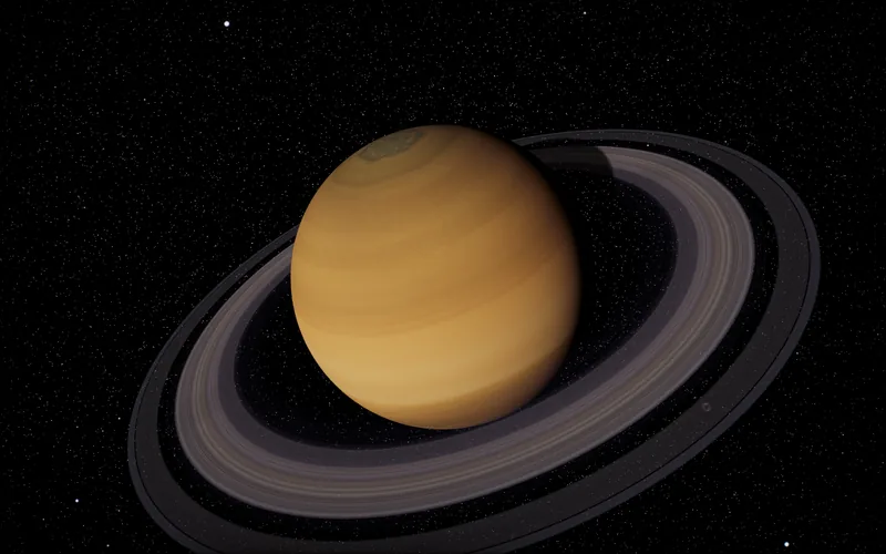
Saturn
Hubble's OPAL map of August 2025
The global map from the Hubble Space Telescope's OPAL programme, taken in August 2025, with the north polar hexagon as Cassini saw it in 2017. The rings are a strip of brightness and colour from Hubble with their opacity from a Cassini star occultation.
In the viewer: 4,096 × 2,048 pixels, and the rings 2,048 × 125 pixels.
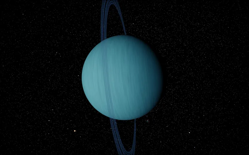
Uranus
Solar System Scope map
Solar System Scope's Uranus map. A map from Hubble's OPAL images of October 2025 is being prepared to replace it.
In the viewer: 2,048 × 1,024 pixels.
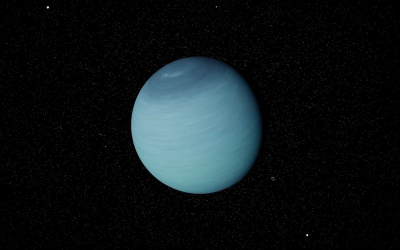
Neptune
Solar System Scope map
Solar System Scope's Neptune map. A map from Voyager 2's 1989 images, coloured from Hubble, is being prepared to replace it.
In the viewer: 2,048 × 1,024 pixels.
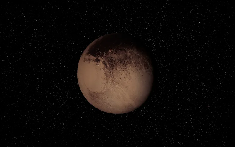
Pluto
NASA's New Horizons, completed where it never looked
The New Horizons team's mosaic, coloured from its global colour map. Where New Horizons saw the ground only from afar, and across the south it never saw, the fine detail is drawn to match Pluto's own terrain and held to the data at the scale the data has.
In the viewer: 8,192 × 4,096 pixels.
Some of the moons and dwarf planets
- Io: Galileo and Voyager images, in the colours of Galileo's true-colour view, 8,192 × 4,096 pixels. USGS Astrogeology, Io Galileo SSI / Voyager Color Merged Global Mosaic. See it in 3D
- Enceladus: The Cassini Imaging Team's global map, 2,048 × 1,024 pixels. USGS Astrogeology, Enceladus Cassini Global Mosaic 110m. See it in 3D
- Triton: Voyager 2's 1989 colour mosaic, 2,048 × 1,024 pixels. USGS Astrogeology, Triton Voyager 2 Global Color Mosaic. See it in 3D
- Charon: The New Horizons team's global mosaic, 4,096 × 2,048 pixels. USGS Astrogeology, Charon New Horizons LORRI MVIC Global Mosaic. See it in 3D
- Ceres: Dawn's Framing Camera colour mosaics, 4,096 × 2,048 pixels. Dawn Framing Camera mosaics of Ceres, NASA PDS. See it in 3D
The credits list the source of every other map in the viewer, the stars and the Milky Way included.
Where to find free planet textures
These are the places the maps above come from. Each is free to use on the terms its own page sets out, so read them and give the credit it asks for.
- USGS Astrogeology USGS data, public domain
Global mosaics and elevation models of Mercury, the Moon, Mars, the big moons, Pluto and Charon, made from spacecraft images. Most are huge and in map projections a GIS reads. - NASA Scientific Visualization Studio, CGI Moon Kit NASA imagery, free to reuse with credit
A colour map and a height map of the Moon made for 3D software, from the Lunar Reconnaissance Orbiter. - NASA Earth Observatory, Blue Marble and Black Marble NASA imagery, free to reuse with credit
The whole Earth by day, month by month, and by night, at up to 500 m a pixel. - NASA Photojournal NASA imagery, free to reuse with credit
Mission images and the occasional global map, such as Cassini's maps of Jupiter. - Hubble OPAL at STScI MAST CC BY 4.0, free to reuse with credit
Yearly global maps of Jupiter, Saturn, Uranus and Neptune from the Hubble Space Telescope. - Solar System Scope CC BY 4.0, free to reuse with credit
Ready-made maps of every planet and the Moon, sized for 3D work and based on NASA imagery and elevation data.
Questions
Can I download the planet textures from this page?
No. The maps here are built and tuned for our viewer, and this page shows where each one comes from. The free originals live at the sources linked under every planet, each under its own terms: NASA and USGS imagery is free to reuse with credit, and Creative Commons BY 4.0 maps need a credit to their makers.
Where can I find free planet textures?
Start with the sources in the list above. USGS Astrogeology and NASA hold the spacecraft mosaics themselves, Hubble's OPAL programme has global maps of the giant planets, and Solar System Scope has ready-made maps of every planet under CC BY 4.0. Read each source's terms and credit it the way it asks.
Why is there no texture for Venus?
Venus is wrapped in cloud, so what you see of it is the cloud tops. The viewer computes them as it draws them, aimed at Venus as it looks in visible light: a pale cream disc with very little contrast.
How does the Earth stay sharp when I zoom right in?
One map cannot hold that much detail. Close to the ground, the viewer streams Landsat and Sentinel-2 imagery tile by tile, down to about 10 m a pixel, on top of the Blue Marble map it shows from far away.
Can I use a screenshot of the viewer?
Our creators page says how to use recordings and stills of the viewer with a credit. A map's own source still applies to the map inside it.
Sources
- Credits: every map in the viewer, its makers and its licence
- NASA imagery, free to reuse with credit
- USGS data, public domain
- CC BY 4.0, free to reuse with credit
- Map sizes are read from the files the viewer loads on a computer when this page was built.